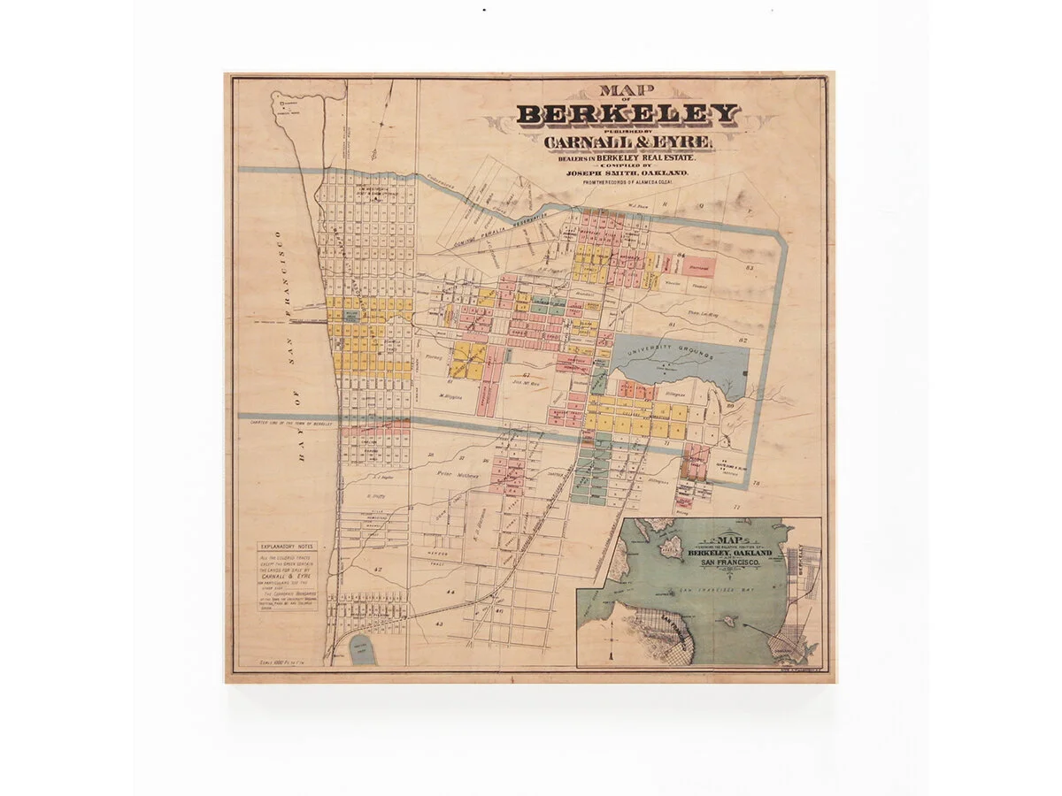
Berkeley, 1880

Berkeley, 1880

$395.00

This artwork is a redesigned reproduction of a vintage map of Berkeley, CA compiled by Joseph Smith of Oakland and published by Carnall & Eyre, dealers in Berkeley Real Estate. The map details drainage, tracts, land ownership, and railroads. The map was sourced from the David Rumsey Map Collection.

Archival Pigment Print on Maple
24"w x 24"h

Hanging hardware included.

Quantity:
Add To Cart

FREE SHIPPING ON ALL ORDERS

FRAME + SHIP DETAILS
 
San Francisco Peninsula, 1869 LLP0007-2.jpg

San Francisco Peninsula, 1869

$435.00
OAKLAND & BROOKLYN, 1869 LP0012-1.jpg

OAKLAND & BROOKLYN, 1869

$465.00
United States, Date Unknown LP015-2.jpg

United States, Date Unknown

$395.00
Bancroft's Official Guide Map of City & County of San Francisco, 1873 LP016-2.jpg

Bancroft's Official Guide Map of City & County of San Francisco, 1873

$395.00
The City and County of San Francisco, 1864 Detail.jpg

The City and County of San Francisco, 1864

$395.00